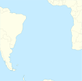
Imachen:South Atlantic Ocean laea location map.svg

Contenido de la página no disponible en otros idiomas.
De Biquipedia

Fichero orichinal(fichero SVG, nominalment 710 × 704 píxels, grandaria: 93 kB)

Iste fichero ye de Wikimedia Commons y pueden emplegar-lo atros prochectos. Debaixo s'amuestra a descripción d'a suya pachina de descripción.

Resumen

Descripción
English: Relief location map of Atlantic_Ocean.
  • Projection: Lambert azimuthal equal-area projection.
  • Area of interest:
  • N: 10.0° N
  • S: -70.0° N
  • W: -60.0° E
  • E: 20.0° E
  • Projection center:
  • NS: -30.0° N
  • WE: -20.0° E
  • GMT projection: -JA-20.0/-30.0/180/19.998266666666666c
  • GMT region: -R-101.75576886232234/-51.72069985658921/20.062665960105004/15.049750517347888r
  • Land and shoreline: 1:110m Natural Earth Datasets, borders 1:50m
Calendata
Fuent Treballo de qui la cargó
Autor Tentotwo

Shell script for generating the map using GMT archive copy at the Wayback Machine

#!/bin/sh

# Set common options
PROJECTION=A-20.0/-30.0/180/19.998266666666666c
REGION=-101.75576886232234/-51.72069985658921/20.062665960105004/15.049750517347888r
FILENAME=South_Atlantic_Ocean_laea_location_map.ps

# Get Natural Earth datafiles
echo "Downloading datafiles from naturalearthdata.com"
wget -nv -nc \
 http://www.naturalearthdata.com/http//www.naturalearthdata.com/download/110m/physical/110m-coastline.zip\
 http://www.naturalearthdata.com/http//www.naturalearthdata.com/download/110m/physical/110m-land.zip\
 http://www.naturalearthdata.com/http//www.naturalearthdata.com/download/110m/cultural/110m-admin-0-boundary-lines.zip
echo "...done\n"

echo "Inflating archives"
unzip 110m\*.zip
echo "...done\n"

echo "Converting shapefiles to GMT"
ogr2ogr -F GMT 110m_land.gmt 110m_land.shp
ogr2ogr -F GMT 110m_coastline.gmt 110m_coastline.shp
ogr2ogr -F GMT 50m_borders.gmt ne_50m_admin_0_boundary_lines_land.shp
echo "...done\n"

echo "Creating maps"
GMT psxy -m -J$PROJECTION -R$REGION --PAGE_COLOR=198/236/255  --POLAR_CAP=none --PAPER_MEDIA=A3  --BASEMAP_TYPE=plain --BASEMAP_AXES=NESW --FRAME_PEN=0.15p,black 110m_land.gmt -K -G254/254/233 > $FILENAME
GMT psxy -m -J$PROJECTION -R$REGION 110m_coastline.gmt -O -K -W0.535p,9/120/171  >> $FILENAME
GMT psxy -m -J$PROJECTION -R$REGION 50m_borders.gmt -O -W100/100/100  >> $FILENAME
echo "...done\n"

echo "You can now open $FILENAME in Inkscape to clean up the file and save it as SVG. You should add an ocean coloured background and simplify the graticules using CTRL+L."

gv $FILENAME

Licenciando

Yo, o titular d'os dreitos d'autor d'ista obra, la publico en os termins d'a siguient licencia:
w:an:Creative Commons
atribución d'autoría compartir igual
Iste fichero se troba baixo a licencia Creative Commons Chenerica d'Atribución/Compartir-Igual 3.0.
Ye libre:
  • de compartir – de copiar, distribuir y transmitir o treballo
  • de remezclar – d'adaptar o treballo
Baixo as siguients condicions:
  • atribución d'autoría – Ha d'atribuir l'autoría d'o treballo d'a traza especificada por l'autor u persona que l'haiga licenciau (pero no pas de traza que suchiera que l'autor/os autors refirma(n) u refirma(n) l'uso que faigas d'o treballo).
  • compartir igual – En caso d'alterar, transformar u enamplar iste treballo, habrá de distribuir o treballo resultant solament baixo a mesma licencia u beluna equivalent.

Leyendas

Añade una explicación corta acerca de lo que representa este archivo

Elementos representados en este archivo

representa a espanyol

creador espanyol

Algún valor sin elemento de Wikidata

licencia espanyol

CC-BY-SA 3.0 espanyol

Historial d'o fichero

Punche en una calendata/hora ta veyer o fichero como amaneixeba por ixas envueltas.

Calendata/HoraMiniaturaDimensionsUsuarioComentario
actual09:58 1 feb 2012Miniatura d'a versión de 09:58 1 feb 2012710 × 704 (93 kB)Tentotwo

Uso de fichers globals

Os siguients wikis fan servir iste fichero:

Veyer mas información sobre l'uso global d'iste fichero.