Imachen:Roman Empire 125.png

Contenido de la página no disponible en otros idiomas.
De Biquipedia

Fichero orichinal(2186 × 1817 píxels; grandaria d'o fichero: 4,43 MB; tipo MIME: image/png)

Iste fichero ye de Wikimedia Commons y pueden emplegar-lo atros prochectos. Debaixo s'amuestra a descripción d'a suya pachina de descripción.

Posición de la cámara45° 00′ 00″ N, 20° 00′ 00″ E Kartographer map based on OpenStreetMap.Ubicación de esta y otras imágenes en: OpenStreetMapinfo

Resumen

Descripción
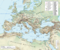
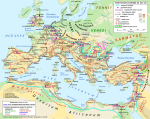
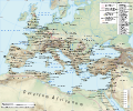
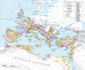
English: Map of the Roman Empire in 125 during the reign of emperor Hadrian, with anachronistic Germanic tribes from the time of Augustus.

Projection

Lambert azimuthal-equal area. Central latitude: 45° N, central longitude: 20° E. X, Y origin offset - 0

Datum: ETRS89

Sources

The physical map was made using the following public domain sources:

Additional references for the map content:

  • Tacitus, Germania (ca. 100)
  • Ptolemy, Geographia (ca. 140)
  • Atlante storico DeAgostini, Instituto Geografico DeAgostini, 1998. pg. 35-41.
  • Historischer Weltatlas, Dr. Walter Leisering, Marix Verlag, 2011. pg. 26-27
  • Történelmi világatlasz, Cartographia Kiadó, 2005. pg. 20-21.
  • The Penguin Historical Atlas of Ancient Rome by Christopher Scarre, Penguin Historical Atlases, 1995. pg. 81.

Software used

GIS:

Graphics editors:

Calendata
Fuent Treballo de qui la cargó
Autor
Permiso
(Reutilización d'iste fichero)
Any use of this map can be made as long as you credit the author, Andrei N. (Wikipedia Commons user Andrein), and distribute the copies and derivative works under the same license as that the one stated below.
Atras versions [editar]
File:Roman Empire 125.svg es una versión vectorial de este archivo. Debería usarse esa versión en lugar de este archivo PNG, cuando sea mejor.

File:Roman Empire 125.png → File:Roman Empire 125.svg

Para más información, lee Ayuda:SVG.

En otros idiomas
Alemannisch  Bahasa Indonesia  Bahasa Melayu  British English  català  čeština  dansk  Deutsch  eesti  English  español  Esperanto  euskara  français  Frysk  galego  hrvatski  Ido  italiano  lietuvių  magyar  Nederlands  norsk bokmål  norsk nynorsk  occitan  Plattdüütsch  polski  português  português do Brasil  română  Scots  sicilianu  slovenčina  slovenščina  suomi  svenska  Tiếng Việt  Türkçe  vèneto  Ελληνικά  беларуская (тарашкевіца)  български  македонски  нохчийн  русский  српски / srpski  татарча/tatarça  українська  ქართული  հայերեն  বাংলা  தமிழ்  മലയാളം  ไทย  한국어  日本語  简体中文  繁體中文  עברית  العربية  فارسی  +/−
Nueva imagen SVG

General map
Political map

Licenciando

Yo, titular d'os dreitos d'autor d'ista obra, la publico en os termins d'as siguients licencias:
w:an:Creative Commons
atribución d'autoría compartir igual
Iste fichero se troba baixo a licencia Creative Commons Chenerica d'Atribución/Compartir-Igual 3.0.
Ye libre:
  • de compartir – de copiar, distribuir y transmitir o treballo
  • de remezclar – d'adaptar o treballo
Baixo as siguients condicions:
  • atribución d'autoría – Ha d'atribuir l'autoría d'o treballo d'a traza especificada por l'autor u persona que l'haiga licenciau (pero no pas de traza que suchiera que l'autor/os autors refirma(n) u refirma(n) l'uso que faigas d'o treballo).
  • compartir igual – En caso d'alterar, transformar u enamplar iste treballo, habrá de distribuir o treballo resultant solament baixo a mesma licencia u beluna equivalent.
GNU head Se gosa premetir a copia, a destribución y a modificación d'iste decumento baixo d'os termins d'a licencia de decumentación libre GNU, Versión 1.2 u qualsiquier altra versión posteriorment expublicata por a Free Software Foundation; sin de seccions invariaderas (Unvariant Sections), textos de portalada (Front-Cover Texts), ni textos de contraportalada (Back-Cover Texts). S'enclui una copia d'ista licencia en anglés en l'articlo GNU Free Documentation License".
Vusté puet utilizar a licencia que s'estime mas.
Mapas de la historia de Europa
BCE
aC

Weichselian ice age (c. 113,000–9700) · Neolithic expansion (c. 7000–4500) · Middle Neolithic (c. 4500–4000) · Late Neolithic (c. 4000–3000) · Copper Age – Corded Ware culture (c. 2900–2350) · Copper Age – Bellbeaker culture (c. 2800–1800) · Early Bronze Age – Unetice culture (c. 2300–1600) · Late Bronze Age – Urnfield culture (c. 1300—750) · Migrations (c. 1000–100) · Hallstatt & La Tène cultures (c. 800–100) · Roman Republic (510–40) · 220 · 218 · 200 · 201–100 · 58 · 49 · 39 · 30 BCE–6 CE


CE
dC

14 · 14–37 · 60 · 60 · 69 · 80 · Migrations 100–500 · 117 · 117 · 125 · Migrations 150–774 · Economy 180 · 271 · 293–305 · 337 · 395 · c. 395 · 400 · 400 · 450 · 457–61 · 476 · 480 · Franks 481–814 · Early Slavs 500–700 · 500 · 526 · 526–600 · Christianisation to 600 · c. 550 · 650 · Pontic Steppe 650 · 665 · 800 · Vikings 800–1050 · 814 · 843–70 · 850 · 900 · 912 · 998 · 1000 · 1000 · 1054 · 1092 · First Crusade 1095–99 · 1097 · 1135 · 1142 · 1147–49 · 1190 · 1190 · 1250 · c. 1250 · 1301-1400 · 1301-1400 · 1328 · 1345 · Black Plague 1347–51 · 1360 · 1400 · Trade routes c. 1400 · 1430 · 1470 · 1490 · 1492 · 1500 · 1519 · 1550 · 1560 · Religion 1560 · Religion 1600 · Religion 1618 · 1618–48 · 1648 · 1683 · 1700 · 1701 · 1708 · 1714 · 1721 · 1725–30 · 1739–1740 · 1740 · 1748–66 · 1783–1792 · 1787 · 1787 · 1789 · 1799 · 1812 · 1812 · 1812 · 1812 · 1813 · 1815 · 1815 · 1815 · 1818 · Ottoman Empire 1830–1923 · 1848–49 · 1861 · 1867 · 1871 · 1878 · 1890 · 1905 · 1911 · 1914 · 1914 · 1919 · 1919–29 · 1923 · 1929 · 1930 · 1940 · 1941–42 · 1942–45 · Cold War 1947–91 · 1950 · 1993–2006 · 2006 to date

(this template: · view · discuss )

Leyendas

Añade una explicación corta acerca de lo que representa este archivo
The Roman empire under Hadrian (ruled 117–138) showing the location of roads, cities, provincial boundaries, naval bases, the Roman legions deployed in 125 AD and Germanic tribes from the time of Augustus

Elementos representados en este archivo

representa a espanyol

45°0'0.000"N, 20°0'0.000"E

tipo de archivo espanyol

image/png

Historial d'o fichero

Punche en una calendata/hora ta veyer o fichero como amaneixeba por ixas envueltas.

(zagueras | primeras) Veyer (10 más recients | ) (10 | 20 | 50 | 100 | 250 | 500)
Calendata/HoraMiniaturaDimensionsUsuarioComentario
actual19:34 12 chi 2019Miniatura d'a versión de 19:34 12 chi 20192186 × 1817 (4,43 MB)ArdadNThis purpose of this map is not to represent ancient shorelines. Please upload a separate file with your original contributions!
16:18 17 set 2018Miniatura d'a versión de 16:18 17 set 20182186 × 1817 (4,37 MB)Julieta39Shorelines of the time (Westermann Grosser Atlas zur Weltgeschichte, Braunschweig 1985, p. 36, 38, 39, ISBN 3-14-10-0919-8 and Andrein' s [https://commons.wikimedia.org/wiki/File:Danube_Delta_evolution.gif] since L. Giosan).
18:16 20 chul 2015Miniatura d'a versión de 18:16 20 chul 20152186 × 1817 (4,43 MB)ArdadN1
17:49 20 chul 2015Miniatura d'a versión de 17:49 20 chul 20152186 × 1817 (4,43 MB)ArdadN1
18:47 3 mar 2015Miniatura d'a versión de 18:47 3 mar 20152186 × 1817 (4,43 MB)ArdadNfixing text problems
17:06 3 mar 2015Miniatura d'a versión de 17:06 3 mar 20152186 × 1817 (4,38 MB)ArdadNnew road added
13:26 10 feb 2015Miniatura d'a versión de 13:26 10 feb 20152186 × 1817 (4,43 MB)ArdadN1
18:45 20 may 2014Miniatura d'a versión de 18:45 20 may 20142186 × 1817 (4,43 MB)ArdadN1
18:20 9 abr 2014Miniatura d'a versión de 18:20 9 abr 20142186 × 1817 (4,43 MB)ArdadNScotti
15:39 30 mar 2014Miniatura d'a versión de 15:39 30 mar 20142186 × 1817 (4,43 MB)ArdadN1
(zagueras | primeras) Veyer (10 más recients | ) (10 | 20 | 50 | 100 | 250 | 500)

A pachina siguient emplega iste fichero:

Uso de fichers globals

Os siguients wikis fan servir iste fichero:

Veyer mas información sobre l'uso global d'iste fichero.

Metadatos