
Imachen:Nye fylker - regjeringen.no.svg

Fichero orichinal (fichero SVG, nominalment 515 × 689 píxels, grandaria: 85 kB)
Resumen
| Descripción |
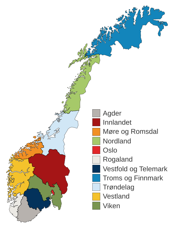
English: Municipal and regional reform: "On 8 June 2017, the Storting decided the following merger of counties". Illustration included.
Norsk bokmål: Kommune- og regionreform: "Stortinget vedtok 8. juni 2017 følgende sammenslåinger av fylker". Medfølgende kart-illustrasjon. |
|||
| Calendata | ||||
| Fuent |
Este archivo deriva de: Fylkeskart-regionreform.jpg |
|||
| Autor | Furfur | |||
| Permiso (Reutilización d'iste fichero) |
|
|||
| Atras versions |
|
|||
| SVG desarrollo |


Historial d'o fichero
Punche en una calendata/hora ta veyer o fichero como amaneixeba por ixas envueltas.
| Calendata/Hora | Miniatura | Dimensions | Usuario | Comentario | |
|---|---|---|---|---|---|
| actual | 01:54 3 chi 2020 | | 515 × 689 (85 kB) | Furfur | Korr. |
| 01:42 3 chi 2020 |  | 515 × 689 (85 kB) | Furfur | == {{int:filedesc}} == {{Information |Description={{User:Medium69/Traduction}} {{no|1=Kommune- og regionreform: "Stortinget vedtok 8. juni 2017 følgende sammenslåinger av fylker". Medfølgende kart-illustrasjon. }} |Source={{Derived from|Fylkeskart-regionreform.jpg}} *[https://www.regjeringen.no/no/tema/kommuner-og-regioner/regionreform/regionreform/nye-fylker/id2548426/ Nye fylker] |Date=2020-01-03 |Author={{U|Furfur}} |Permission={{self|GFDL|cc-by-sa-4.0}} |Other versions={{bva|Fylkeskart-re... |
Uso d'o fichero
Garra pachina tiene un vinclo ta iste fichero.
Uso de fichers globals
Os siguients wikis fan servir iste fichero:
- Uso en bs.wikipedia.org
- Uso en ca.wikipedia.org
- Uso en da.wikipedia.org
- Uso en el.wikipedia.org
- Uso en en.wikipedia.org
- Uso en es.wikipedia.org
- Uso en fa.wikipedia.org
- Uso en fi.wikipedia.org
- Uso en he.wikipedia.org
- Uso en hu.wikipedia.org
- Uso en is.wikipedia.org
- Uso en it.wikipedia.org
- Uso en jv.wikipedia.org
- Uso en ko.wikipedia.org
- Uso en nl.wikipedia.org
- Uso en nn.wikipedia.org
Veyer mas información sobre l'uso global d'iste fichero.