
Imachen:Guyana location map.svg

Tamaño de esta previsualización PNG del archivo SVG: 407 × 599 pixels. Atras resolucions: 163 × 240 pixels | 326 × 480 pixels | 522 × 768 pixels | 695 × 1024 pixels | 1391 × 2048 pixels | 1252 × 1843 pixels.
Fichero orichinal (fichero SVG, nominalment 1252 × 1843 píxels, grandaria: 293 kB)
Resumen
| Descripción |
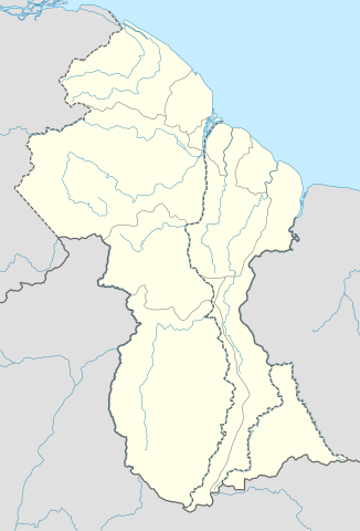
Deutsch: Positionskarte von Guyana
Quadratische Plattkarte. Geographische Begrenzung der Karte:
English: Location map of Guyana
Equirectangular projection. Geographic limits of the map:
|
| Calendata | 02.12.2008 |
| Fuent |
own work, using
|
| Autor | NordNordWest |
| Atras versions | Derivative works of this file: Guyana relief location map.jpg |

|
Este mapa se ha hecho o mejorado en el Kartenwerkstatt (taller cartográfico) alemán. También puede proponer mapas para mejorar.
|
Licenciando
Yo, titular d'os dreitos d'autor d'ista obra, la publico en os termins d'as siguients licencias:

|
Se gosa premetir a copia, a destribución y a modificación d'iste decumento baixo d'os termins d'a licencia de decumentación libre GNU, Versión 1.2 u qualsiquier altra versión posteriorment expublicata por a Free Software Foundation; sin de seccions invariaderas (Unvariant Sections), textos de portalada (Front-Cover Texts), ni textos de contraportalada (Back-Cover Texts). S'enclui una copia d'ista licencia en anglés en l'articlo GNU Free Documentation License". |
Iste fichero se troba baixo a licencia Creative Commons Chenerica d'Atribución/Compartir-Igual 3.0.
- Ye libre:
- de compartir – de copiar, distribuir y transmitir o treballo
- de remezclar – d'adaptar o treballo
- Baixo as siguients condicions:
- atribución d'autoría – Ha d'atribuir l'autoría d'o treballo d'a traza especificada por l'autor u persona que l'haiga licenciau (pero no pas de traza que suchiera que l'autor/os autors refirma(n) u refirma(n) l'uso que faigas d'o treballo).
- compartir igual – En caso d'alterar, transformar u enamplar iste treballo, habrá de distribuir o treballo resultant solament baixo a mesma licencia u beluna equivalent.
Vusté puet utilizar a licencia que s'estime mas.
Historial d'o fichero
Punche en una calendata/hora ta veyer o fichero como amaneixeba por ixas envueltas.
| Calendata/Hora | Miniatura | Dimensions | Usuario | Comentario | |
|---|---|---|---|---|---|
| actual | 17:03 15 set 2017 | | 1252 × 1843 (293 kB) | Milenioscuro | corrected disputed border with Venezuela |
| 04:09 28 set 2013 |  | 1252 × 1843 (342 kB) | Unukalhai | Reverted to version as of 04:34, 16 October 2012 | |
| 12:36 24 feb 2013 |  | 1252 × 1843 (341 kB) | Wester | Reverted to version as of 19:53, 2 December 2008 | |
| 04:34 16 oct 2012 |  | 1252 × 1843 (342 kB) | Unukalhai | Including disputed area by Venezuela, the same way wich the surinamese one appears in the map. http://treaties.un.org/pages/showDetails.aspx?objid=080000028012b96f | |
| 19:53 2 avi 2008 |  | 1252 × 1843 (341 kB) | NordNordWest | {{Information |Description= {{de|Positionskarte von Guyana}} Quadratische Plattkarte. Geographische Begrenzung der Karte: * N: 8.7° N * S: 0.9° N * W: 61.6° W * O: 56.3° W {{en|Location map of Guyana}} Equirectangular pro |
Uso d'o fichero
A pachina siguient emplega iste fichero:
Uso de fichers globals
Os siguients wikis fan servir iste fichero:
- Uso en af.wikipedia.org
- Uso en ar.wikipedia.org
- Uso en ast.wikipedia.org
- Uso en az.wikipedia.org
- Uso en ba.wikipedia.org
- Uso en be-tarask.wikipedia.org
- Uso en be.wikipedia.org
- Uso en bg.wikipedia.org
- Uso en bn.wikipedia.org
- Uso en bs.wikipedia.org
- Uso en ceb.wikipedia.org
Veyer mas información sobre l'uso global d'iste fichero.