
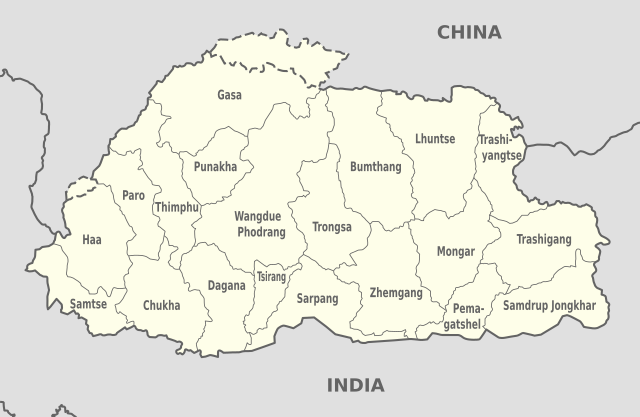
Imachen:Bhutan (+claims), administrative divisions - en - monochrome.svg

Tamaño de esta previsualización PNG del archivo SVG: 800 × 522 pixels. Atras resolucions: 320 × 209 pixels | 640 × 417 pixels | 1024 × 668 pixels | 1280 × 835 pixels | 2560 × 1670 pixels | 874 × 570 pixels.
Fichero orichinal (fichero SVG, nominalment 874 × 570 píxels, grandaria: 239 kB)
Resumen


.svg)


_(Paris_zoom).svg)
.svg)
,_administrative_divisions_-_de_-_colored_(multizoom).svg)
_-_colored.svg)
.svg)
,_administrative_divisions_-_Nmbrs_(multizoom).svg)
,_administrative_divisions_-_de_-_colored.svg)
_-_de_-_colored.svg)

.svg)

.svg)
,_administrative_divisions_-_en_-_monochrome.svg)
Licenciando
Yo, titular d'os dreitos d'autor d'ista obra, la publico en os termins d'as siguients licencias:

|
Se gosa premetir a copia, a destribución y a modificación d'iste decumento baixo d'os termins d'a licencia de decumentación libre GNU, Versión 1.2 u qualsiquier altra versión posteriorment expublicata por a Free Software Foundation; sin de seccions invariaderas (Unvariant Sections), textos de portalada (Front-Cover Texts), ni textos de contraportalada (Back-Cover Texts). S'enclui una copia d'ista licencia en anglés en l'articlo GNU Free Documentation License". |
Iste fichero se troba baixo a licencia Creative Commons Chenerica d'Atribución/Compartir-Igual 3.0.
- Ye libre:
- de compartir – de copiar, distribuir y transmitir o treballo
- de remezclar – d'adaptar o treballo
- Baixo as siguients condicions:
- atribución d'autoría – Ha d'atribuir l'autoría d'o treballo d'a traza especificada por l'autor u persona que l'haiga licenciau (pero no pas de traza que suchiera que l'autor/os autors refirma(n) u refirma(n) l'uso que faigas d'o treballo).
- compartir igual – En caso d'alterar, transformar u enamplar iste treballo, habrá de distribuir o treballo resultant solament baixo a mesma licencia u beluna equivalent.
Vusté puet utilizar a licencia que s'estime mas.

|
Le agradecería que usted atribuyera este trabajo a Wikimedia Commons, si se utilizase fuera de Wikipedia o Commons. Para su uso en publicaciones (tales como libros, periódicos, blogs, sitios web, etc.) por favor, infórmeme aquí:
|
,_administrative_divisions_-_en_-_monochrome.svg&action=edit&redlink=1)
Historial d'o fichero
Punche en una calendata/hora ta veyer o fichero como amaneixeba por ixas envueltas.
| Calendata/Hora | Miniatura | Dimensions | Usuario | Comentario | |
|---|---|---|---|---|---|
| actual | 05:56 18 nov 2022 | | 874 × 570 (239 kB) | Darafsh | File uploaded using svgtranslate tool (https://svgtranslate.toolforge.org/). Added translation for fa. |
| 08:38 20 chun 2019 |  | 874 × 570 (238 kB) | NordNordWest | == {{int:filedesc}} == {{Information |Description={{de|Karte der politischen Gliederung von XY (siehe Dateiname)}} {{en|Map of administrative divisions of XY (see filename)}} |Source={{own}}{{Adobe Illustrator}}{{Commonist}}{{AttribSVG|Bhutan_location_map.svg|NordNordWest}} |Date=2019-06-20 |Author={{TUBS}} + {{U|NordNordWest}} |Permission= |other_versions={{SVG labeled maps of administrative divisions (location map scheme)}} }} == {{int:license-header}} == {{self|GFDL|cc-by-sa-3.0}}{{TUBS/C... |
Uso d'o fichero
A pachina siguient emplega iste fichero:
Uso de fichers globals
Os siguients wikis fan servir iste fichero:
- Uso en ca.wikipedia.org
- Uso en en.wikipedia.org
- Uso en es.wikipedia.org
- Uso en eu.wikipedia.org
- Uso en fa.wikipedia.org
- Uso en hu.wikipedia.org
- Uso en ta.wikipedia.org
- Uso en tum.wikipedia.org
- Uso en vi.wikipedia.org
,_administrative_divisions_-_en_-_monochrome.svg)